 Delingan Reservoir or Tirtomarto Reservoir is an artificial reservoir located on Jalan Raya Karanganyar-Mojogedang KM 5, Pojok hamlet, Delingan Village, Karanganyar District, Karanganyar Regency, Central Java Province and its location close to Wana Wisata Gunung Bromo Karanganyar.
The Dutch East Indies government began to build the Tirtomarto Reservoir in 1920 and was completed in 1923. The Delingan Reservoir or Tirtomarto Reservoir has a peak elevation of 179 meters, has an area of approximately 47 hectares (normal) and around 50 hectares (flood) with effective volume 2 , 07 million cubic meters and the Delphi Reservoir or Tirtomarto Reservoir are capable of irrigating an area of approximately 10,000 hectares of rice fields.
This Tirtomarto Reservoir was rehabilitated on March 8, 1999 on the Bengawan Solo Water Source Development and Conservation Project (PKSA) by the Department of Public Works (DPU). The rehabilitation work includes repairing the body of the building and repairing the reservoir water transfer door. However, over time, the current condition of the Tirtomarto Reservoir with a water catchment area (DTA) of 1,200 hectares is quite alarming when viewed from the continuity of water availability. This is due to the occurrence of sedimentation in the reservoir which is not getting serious treatment. Reservoirs that were originally able to provide water throughout the year, are currently in dry conditions during the dry season, so that they are no longer able to meet the water needs of the rice fields.
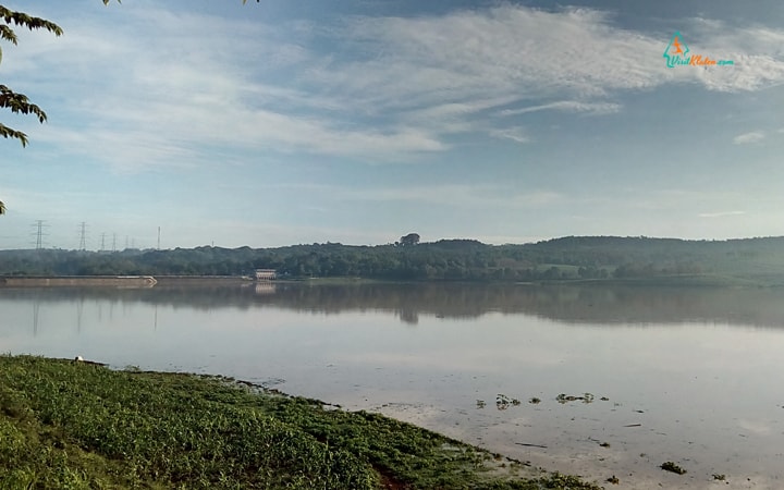
The Tirtomarto Reservoir is now managed by the Central Bengawan Solo River Region (BBWSBS), which is one of the Work Units (Satker) of the Ministry of Public Works (PU). Tirtomarto Reservoir has a pretty good geographical condition. The reservoir is surrounded by rolling hills, green trees, agricultural land that provides coolness and beautiful scenery around the reservoir. The reservoir which was originally built for the needs of sufficient agricultural irrigation water needs in the Delingan or surrounding areas, could be further developed for tourism such as natural tourism or water sports tourism.
With an atmosphere that is not so hot in the afternoon accompanied by gentle breeze that blows and sees the vast expanse of reservoir water, makes it want to linger on the edge of the Delingan reservoir and feels very pleasant. If you feel tired and want to eat or drink while resting, you can take snacks in simple stalls, although there are not so many in the north and west side of the reservoir that can be used as a place to rest.
Map Location
Video
Thank you for visiting our website
Visit klaten – Klaten Tourism and Advertising Map – Let’s Go To Klaten !.
Is a media of Tourism Information and Advertising Media in the area Klaten, Surakarta, Yogyakarta, Boyolali, Karanganyar and surrounding areas.
Share if useful, if any criticism, additional and suggestion please contact us or please fill in comment field
#visitklaten #visitklatencom #klaten
#huntingfoto, #biking, #boyolali, #exploreindonesia, #indonesia, #instagramable, #karanganyar, #klaten, #pariwisata, #populer, #solo, #spotselfie, #surakarta, #visitcentraljava, #visitindonesia, #visitklaten, #visitklaten.com, #visitklatencom, #wisatawan, #wonderfulindonesia, #wonderfuljateng, #wonderfulklaten,#yogyakarta, #wonogiri, #sragen, #agrowisataalam #pojok #delingan #DelinganReservoir #TirtomartoReservoir #artificialreservoir
